Avia Maps Aeronautical Charts: The Ultimate App for Pilots and Aerospace Enthusiasts
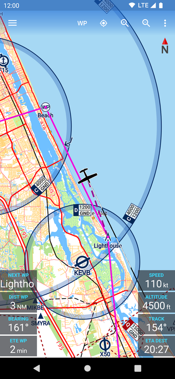
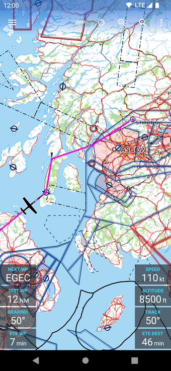
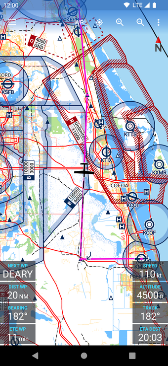
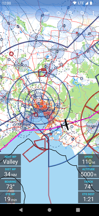
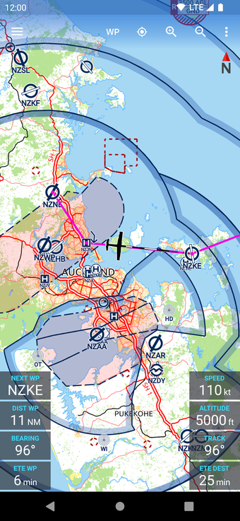
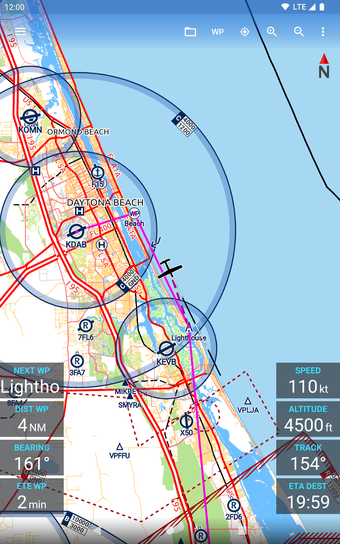
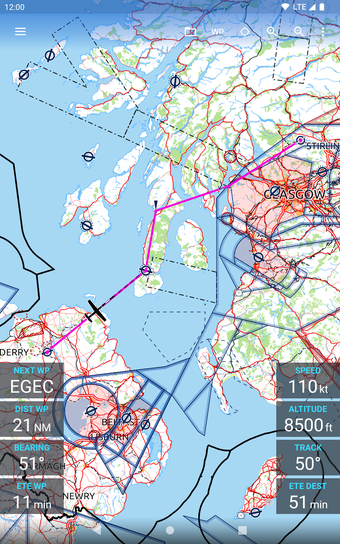
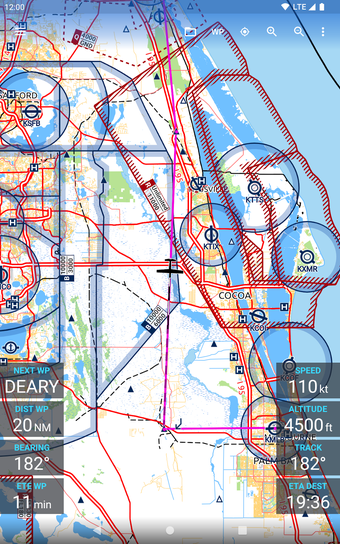
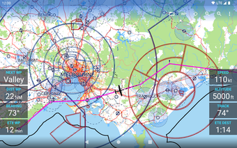
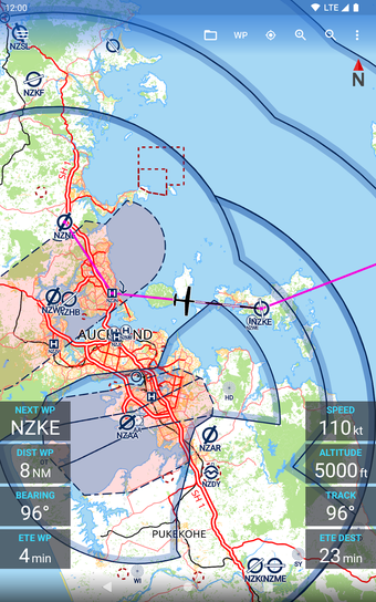
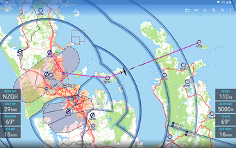
Avia Maps Aeronautical Charts, developed by Remy Webservices UG, is a reliable and straightforward aviation map app that caters to pilots and aerospace enthusiasts worldwide. The app is designed for both pre-flight planning and in-flight navigation and offers an extensive database of information. Users can select any 5 by 5-degree area on earth and download relevant data for offline use, making it an ideal tool for use in areas with no internet access.
Top Recommended Alternative
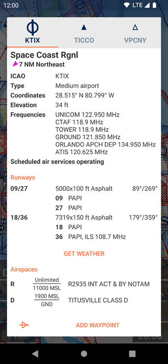
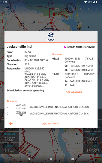
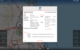
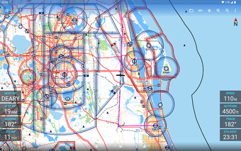
The app boasts over 65,000 airports, 9,000 navaids, and 15,000 waypoints across the globe, along with airspace data for 62 countries across all continents (excluding Antarctica). The app also offers high-resolution weather forecasts from the German DWD and US American NOAA, providing accurate map layers for cloud cover, ceiling, precipitation, and wind on the ground and aloft.
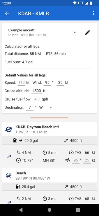
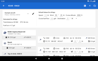
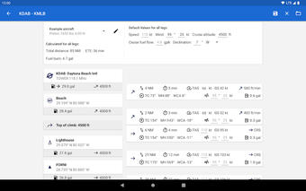
The app's digital elevation model supports route planning in the mountains, and the terrain overlay dynamically colors hills and mountains on the map based on the user's current altitude. To ensure accurate performance calculations, users can create multiple aircraft profiles based on handbook values for climb performance, fuel consumption, and more. Additionally, the app can accurately recreate the climb performance diagram in the user's POH from just four carefully chosen data points.